Key takeaways
- Identify gradient winds by their shiftiness off the land; identify lake breezes by their steady pressure and darker water texture.
- Look for cumulus cloud lines over the shore as a sign that the thermal engine is pulling air off the lake.
- Avoid the 'fighting zone' where opposing winds cancel out, creating a calm strip on the water.
- Commit to the new breeze early if the thermal is expected to overpower a light gradient wind.
The Morning Tug-of-War
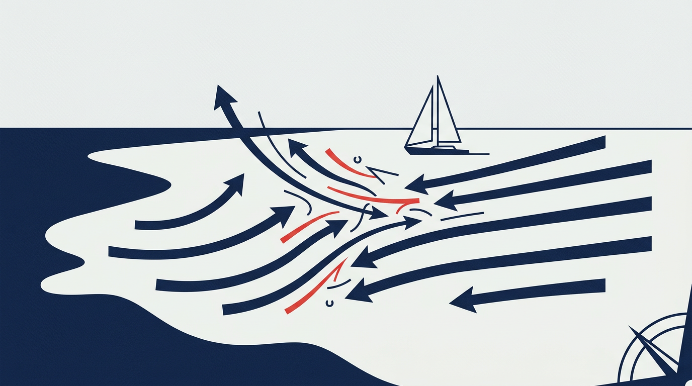
If you’ve spent any time racing out of Milwaukee, Kenosha, or Sheboygan, you know the feeling. You leave the dock in a steady 10-knot Westerly, but as you get out past the breakwall, the air feels unsettled. The flags on the pier are pointing one way, while the clouds above are moving another. This is the classic confrontation between the gradient wind—the wind driven by large-scale pressure systems—and the lake breeze, our local thermal engine.
Understanding which of these two is winning the battle is the difference between sitting in a hole and catching the new pressure first. On Lake Michigan, this battle defines almost every summer afternoon.
Identifying the Gradient Wind
The gradient wind is what you see on the big-picture weather maps. It’s the wind created by the Highs and Lows moving across the Midwest. It’s generally more stable in direction over long periods, but it is often influenced by the friction of the land. In Wisconsin, a West or Northwest gradient wind has to travel over trees, buildings, and hills before it hits the water. This makes it puffy, shifty, and full of holes.
When the gradient wind is strong—usually over 15 knots—it often overpowers the thermal effect. In these cases, the lake breeze never stands a chance. You’ll spend your day playing shifts and looking for puffs coming off the shore. But when that gradient is light (under 10-12 knots), the stage is set for a thermal takeover.
Spotting the Lake Breeze Arrival
The lake breeze is a thermal circulation. As the Wisconsin sun heats the land, the air rises, creating a local low-pressure zone. The cooler, denser air over Lake Michigan rushes in to fill the void.
I remember a specific Tuesday night race in Milwaukee where we started in a dying 5-knot Southwesterly. Halfway up the first beat, we saw a dark line on the eastern horizon. The water looked deeper blue, and the surface had a crisp ripple that didn't match the current wind. That was the lake breeze front.
Here is how you tell them apart on the water:
- Cloud Formations: Look for a line of cumulus clouds forming just inland. This often marks the "front" where the cool lake air is pushing the warm land air upward.
- Surface Texture: Gradient winds coming off the land often look "streaky" with long fingers of wind. A developing lake breeze usually appears as a solid, dark line of ripples advancing from the open water.
- Consistency: The lake breeze is generally denser and steadier. Once it fills in, the oscillations decrease, and you get a more constant, heavy feel in the sails.
The "Fighting Zone" and Strategy
When these two winds clash, they create a convergence zone. This is the most dangerous place to be on a race course. The two winds essentially cancel each other out, leaving a strip of near-calm water.
In a Lake Michigan regatta, if you suspect the lake breeze is coming, you have to commit. If you stay close to the shore hunting for land puffs, you might get stranded while the boats further out in the lake hook into the new thermal and sail right around you.
However, you must be careful with Rule 18 and mark Room during these transitions. When the wind direction flips 180 degrees as the lake breeze hits, the "windward" and "leeward" sides of the boat change instantly. I’ve seen many sailors get confused about their rights under Rule 11 (On the Same Tack, Overlapped) when a sudden thermal shift turns a downwind leg into an upwind beat. Always keep your head on a swivel during the transition.
A Real-World Lake Michigan Example
During a recent coastal race toward Wind Point, we had a light Northerly gradient. The forecast suggested a Southeast lake breeze would develop by 1:00 PM. Most of the fleet stayed on the rhumb line, hugging the shore to minimize distance. We decided to hedge our bets and tacked toward the open lake early.
For twenty minutes, we looked like fools, sailing extra distance in less wind. But then, we felt the temperature drop five degrees. The wind went dead calm for two minutes, and then slammed in from the Southeast at 12 knots. Because we were further East, we hit the new wind first and reached over the top of the fleet that was still stuck in the dying Northerly near the bluffs.
Safety and Stability
Remember that lake breezes can be surprisingly powerful. A 5-knot afternoon can turn into a 18-knot hike-out session in a matter of minutes. Always check that your rig is tuned for the expected increase in tension. If you're caught with a light-air setting when the lake breeze punches in, you'll struggle with excessive heel and weather helm.
Managing the transition between gradient and thermal winds is one part science and two parts observation. Watch the horizon, feel the temperature on the back of your neck, and be ready to change your strategy the moment the big lake starts breathing.
Written by Dmitry Shteyn — Wisconsin sailor and educator. Find more sailing notes on the daily blog or read the longer guides.